Client:
Essendon Fields Airport
Airport Development and Management Firm
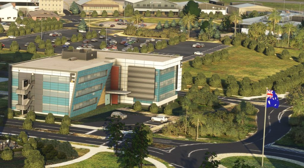
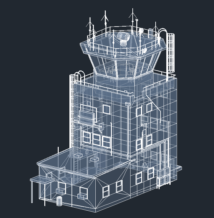
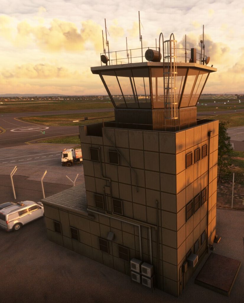
Orbx developed a digital twin for assessing the Air Traffic Control Tower line of sight using a safety focused, technical and evidence-based approach. The client was utilised the outputs to show compliance to civil aviation safety regulations.
Civil Engineers utilised the terrain heights for drainage/Overland flow design
LiDAR Digital Surface and Digital Elevation Models were used to develop the digital twin with high dimensional accuracy.
Advanced 3D modelling, texturing and rendering processes we applied to ensure highly realistic outputs
This case study showcases our expertise in developing sophisticated, regulatory-compliant solutions. Our technical and evidence-based approach ensures accurate real world 3D environments and practical tools for effective decision-making
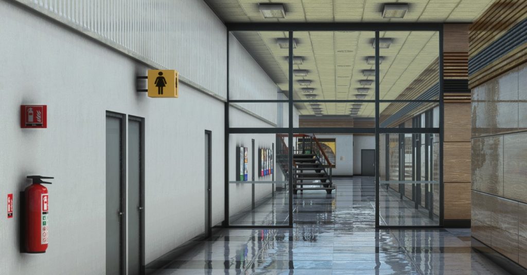
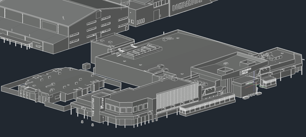
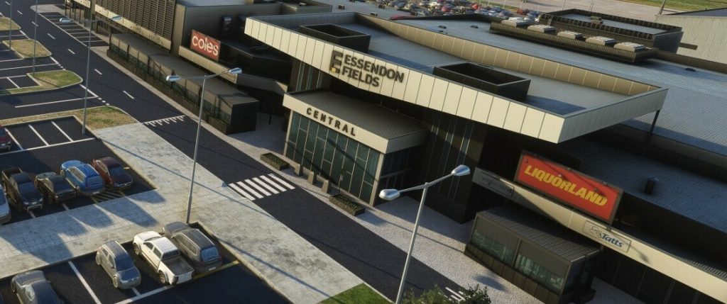
Orbx developed a comprehensive 3D geo-referenced precinct model to accurately represent the on-airport built environment, incorporating all existing structures and potential obstructions. Additionally, we provided advanced visual representation tools that simulate the view from the ATC tower cab, enabling precise assessment of the line of sight for proposed developments.
Our services also include ongoing consultation to refine the methodology and CAD model, ensuring compliance with civil aviation safety regulations and meeting the specific requirements of CASA and Airservices Australia. This approach ensured a safety-focused, technical, and evidence-based assessment for Essendon Field’s airport development projects.